
Welcome to ABIODUN ESAN & CO Surveying & Mapping Ltd.
No1 YOU BUY, WE SURVEYTHE BEST SERVICE YOU CAN TRUSTSURVEYING EXPERT IN NIGERIAYOU BUY, WE SURVEYTHE BEST SERVICE YOU CAN TRUST.
ABIODUN ESAN & CO Surveying & Mapping ltd is a certified Business Enterprise that provides professional Land Surveying and Mapping services to residential, commercial, and public markets throughout Nigeria. We provide services for a large range of customers including local property owners, real estate developers, architects, engineers, construction professionals, real estate agents, title companies, commercial real estate lenders and public agencies

Trusted by hundreds of clients
Join our clients in saving yourself any stress whatsoever on all acquired properties
1,000+
Clients
20 billion naira+
Transactions
12 billion+
Funds Managed
From local property owners and experienced architects, to construction professionals and all aspects of the real estate world, we provides essential land surveyor services.
We are a professional licensed land and property surveyor across Nigeria company with the experience you need to have complete confidence in your plans. We have worked with a wide range of clients across Nigeria. We can be there for aerial mapping, 3D landscaping, and much more.
The benefits of hiring a professional, well-reviewed land and property surveyor company for your project in Lagos or elsewhere are a long list. We combine the most advanced tools and methods available to land surveying, while also making sure your interests are well within the letter of the law from start to finish.
Don’t move forward in your endeavours without having the best possible people in your corner. Contact us today for a consultation.
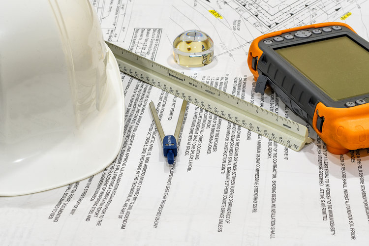
MAPPING
- ALTA/NSPS Land Title Surveys
- Boundary Establishment Maps
- Topographic Maps
- Design Survey Maps
- Architectural Survey Maps
- Slope Analysis Maps
- As-built Surveys
- Plot Plans
- Record of Survey Maps
- Encumbrance Maps
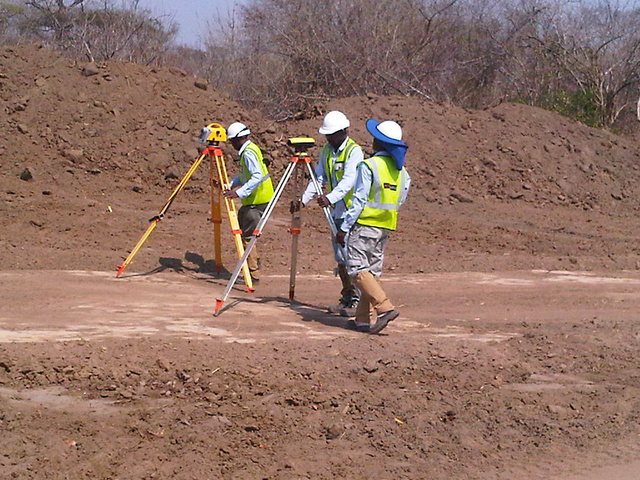
LAND SURVEY
- Lot Line Survey
- Boundary Survey
- Topographic Survey
- Building Height Survey
- As-built Surveys
- Verification Surveys
- Specialty Surveys
- Control Surveys
- Geodetic Control Surveys
- GPS Surveys (Static, RTK, RTN)
- GPS Site Localizations
- Construction Staking
- Deformation Monitoring Survey
- Monument Preservation and Restoration Survey
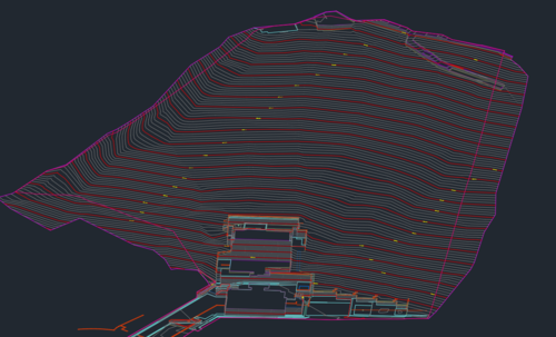
3D MODELLING
OUR MODELING TEAM CAN CREATE:
- Building Information Models ( BIM )
- Site Information Models
- MEP Models
- Underground Utility Models
- Specialty Equipment Models
- Machine Control Models
- Autodesk AutoCAD
- Autodesk Revit
- Autodesk Civil 3D
- Autodesk Navisworks
Comprehensive guide to Lagos state land use charge including Land use Information, Tax Assessor’s Information, Benchmarks, Permits, Department of Public Works services
Surveying is the bedrock of all meaningful developments and the United Nations recognizes that the most developed nations are the most mapped.
Copyright © 2023 ESROP SURVEYING. All rights reserved.
Made in Typedream